Community Corner
Kayaking the Wetlands
Udalls Cove Preservation Committee president writes about his experience kayaking the marshes of northeast Queens.


It goes without saying, but I’ll say it anyhow, that the defining characteristic of wetlands is that they are wet.
This is not quite as obvious as it sounds because there are plenty of places that appear dry but are, scientifically speaking, wetlands.
In such an area, the wetness is hidden just below ground, but the vegetation will be distinctive enough that a biologist can say with confidence that it is, indeed, a wetland.
Find out what's happening in Bayside-Douglastonwith free, real-time updates from Patch.
For most of the wetlands around the Douglaston-Little Neck area, you don’t have to be a biologist to make the call: these areas are plenty wet.
In my last two columns, I described how to access the Udalls Cove Park by foot, and I warned that in some places you’d be likely to get a bit muddy. This week’s column is about accessing the wetlands from the water, where there is absolutely no ambiguity about the wetness factor.
Find out what's happening in Bayside-Douglastonwith free, real-time updates from Patch.
We have thriving salt marshes on both sides of the Douglaston peninsula and one of the best ways to get to know and enjoy them is by kayak or canoe. These boats are quiet, so you won’t need to worry about disturbing the wildlife.
The crafts have a very shallow draft, so you can work your way deep into the marsh. And they are usually light enough so you can carry them to a convenient launch location. Unfortunately, we don’t have many good launch spots that are open to the general public. The Douglas Manor Association’s members can use the Douglaston dock, Memorial Field or Arleigh Beach (my favorite - just slide the boat down the wooden stairs).
Non-members can launch at the Bayside dock or further away in Little Bay near Fort Totten.
Little Neck Bay has a very large tide range - usually eight feet or more between high and low tides. To explore the marshes, you’ll need to confine yourself to the two or (maximum) three hours on either side of high tide.
High and low tides are separated by about six-and-a-half hours, so every day the first high tide will be about an hour later than the day before. To read more about tide tables online, click here.
On the Udalls Cove side of Douglaston, waterways lead north into the salt marsh starting in front of Memorial Field and continuing beyond Virginia Point.
However, access to the large marsh between Little Neck and Great Neck is obstructed by the outfall pipe from the Belgrave Sewage Treatment Plant, which has a low crossing over the creek.
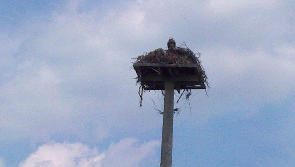
On the western side of the peninsula, between Douglaston and Bayside, you can go much farther. Paddle north past Parson’s Point and weave through the tidal basin where the tall osprey nesting platform stands. As you emerge, you’ll be at the mouth of Alley Creek.
Continue under the Long Island Railroad bridge and explore the newly created tidal basin that extends all the way to the Cross Island Parkway. Back in Alley Creek, keep going north under the Northern Boulevard Bridge and past the recently restored marsh and new viewing platform near the Alley Pond Environmental Center. Keep going north until you can’t go any farther and you’ll find that you’ve paddled about three quarters of the way from Northern Boulevard to the Long Island Expressway.
But for the noise of the cars on the nearby highways, you won’t believe you’re still in New York City.
I prefer kayaks to canoes for this kind of exploration. They are much more stable in wind and waves and easier to maneuver, especially for a single paddler. Kayaks are an amazing craft, invented by the Inuit peoples of the high Arctic. They were made of wooden frames covered with sealskin. That same structure - wood frame and fabric skin - was the preferred design until the 1960s or 1970s, when first fiberglass and then plastic kayaks became available.
I owned one of the first kayaks (perhaps the first) used on Little Neck Bay in modern times. It was a 17-foot long, two-person Folbot, a not-entirely-successful American copy of the classic German folding kayak made by Klepper.
It didn’t fold very easily, but it handled well and was incredibly stable. I first launched it from Arleigh Beach in May 1967.
Today, I use a 9-foot, one-person, bright red Old Town Otter named “Cove Keeper.” It loads easily onto my car top, so I’ve been able to explore farther afield - from Northport to Pelham Bay and City Island as well as all the way west to Hell Gate with its very dangerous, strong currents.
I encourage you to try paddling. You’ll discover it’s the best way to explore the beautiful salt marshes that surround and distinguish our community.